

This post is part of Pete Muhitch’s 2023 O’Donohue Summer Fellowship.
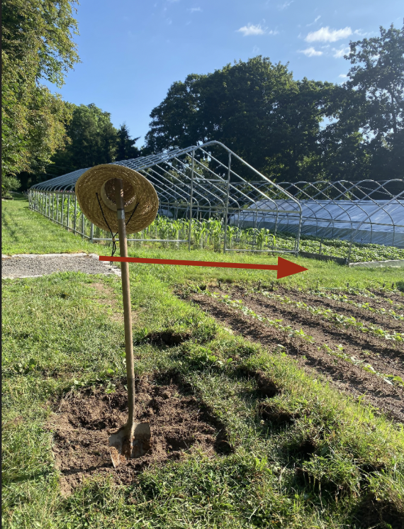
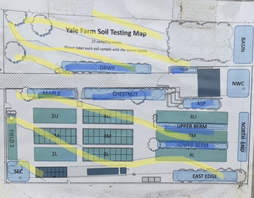
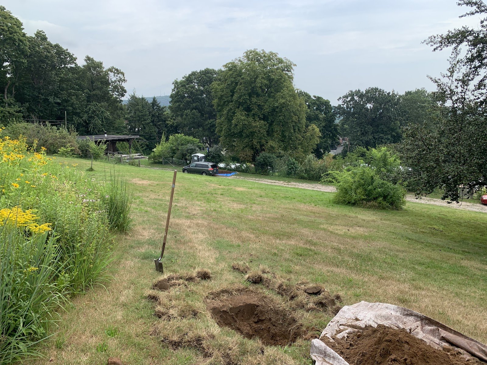
The Yale Farm’s slope uniquely impacts both its above-ground management and the structure and properties of the soil that lies beneath. Along the farm’s hill, are a series of berms running north to south. The berms, consisting of a wonderful variety of perennial herbs and flowers, are in place to mitigate runoff, erosion, and leaching, and carve out a flatter surface for crop production. Pictured below is a map and picture of the farm from the perspective of the path between beds 2U and MAPLE. The yellow lines highlight the elevation change of the land, while the blue lines highlight the berms.
On its own small scale, the Old Acre slope and its terraces tie the Yale Farm into a global history of farming on hillsides. Indeed numerous societies across the world have employed terracing techniques to transform thin-soiled slopes into soils viable for agriculture. A cursory wikipedia search offers rice farming in mountainous areas of Vietnam as one prime example.
Topography is a major factor of a given soil’s development. As biological, chemical, and physical processes weather a parent rock (in the case of the Yale Farm, a reddish sandstone called New Haven Arkose) into soil, gravity can transport soil particles depending on an area's topography. Pictured below is a slide adapted from a presentation from Scott Fendorf PhD, a Stanford University soil scientist. This topography principle suggests that soils at the base of a slope tend to be deeper and wetter, as a result of the leaching and accumulation of fine-particle clays from the upper parts of the slopes. Soils on a slope, therefore, will be shallower and more rich in heavier sand particles, and resultantly are well drained.

With a historic and scientific backdrop of hillside farming, this project aims to study what effects, if any, the slope has yield on the farm’s soil in varying locations. Acknowledging my own lack of expertise in soil science, to the best of my abilities, the goals of this project were to (1) determine the chemical and physical properties of the Yale Farm soil, (2) determine any variance in soil properties versus soil position on the slope, and (3) determine any variance between cultivated and uncultivated soils. In pursuit of accomplishing these goals, I was able to practice soil field analysis techniques, offer scientific suggestions for patterns in the soils, and further inform one thread of the farm’s narrative (its hill!) with data collected.

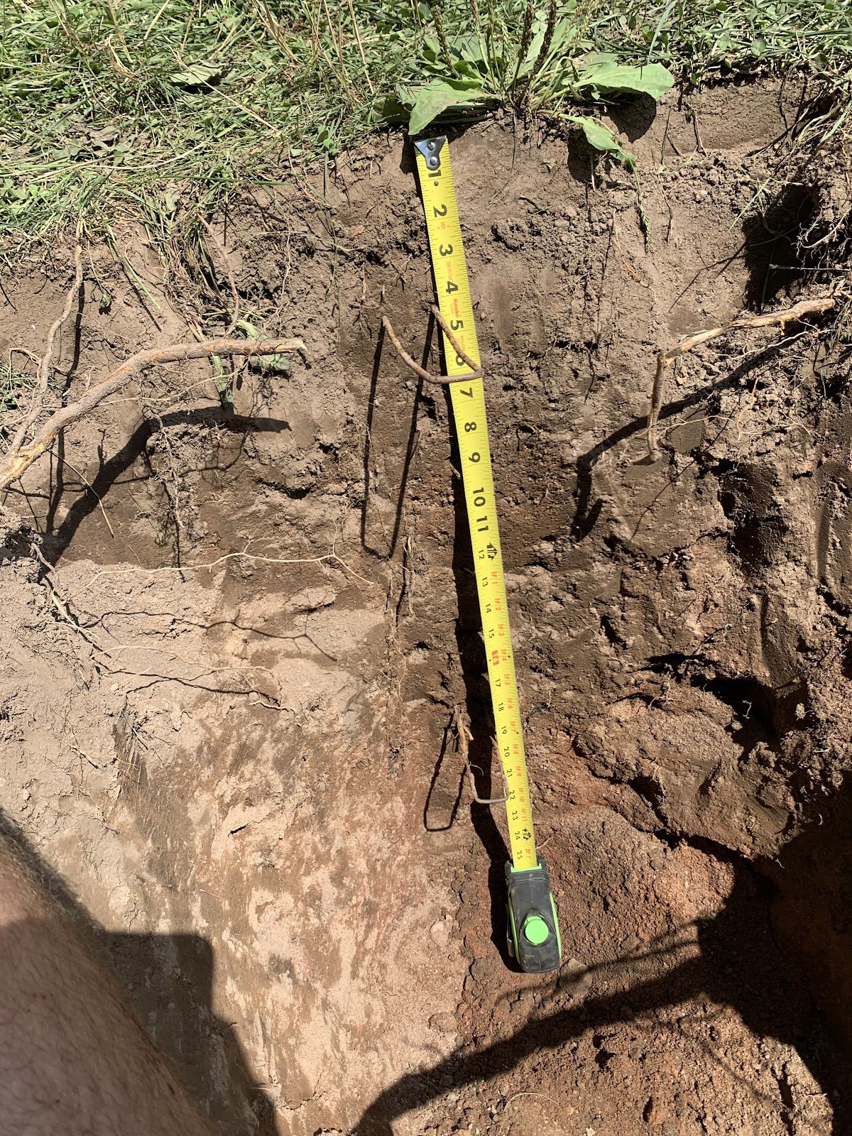
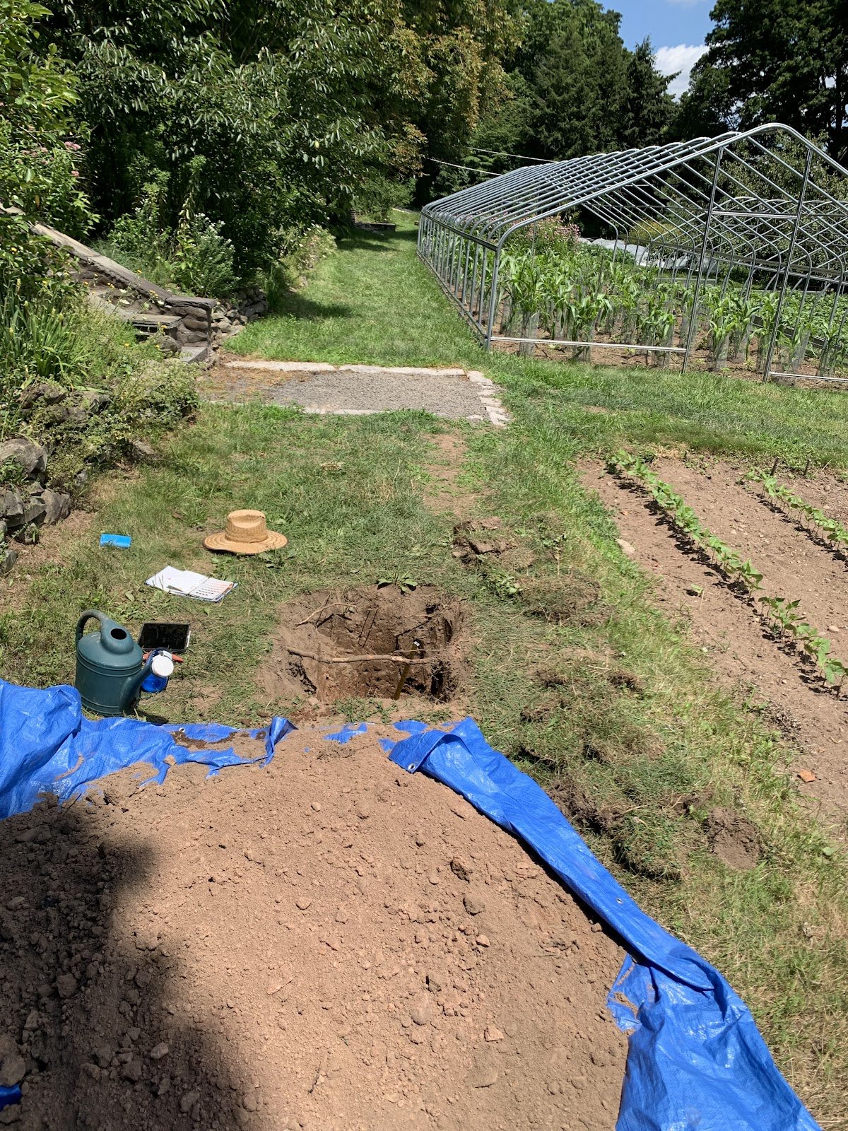
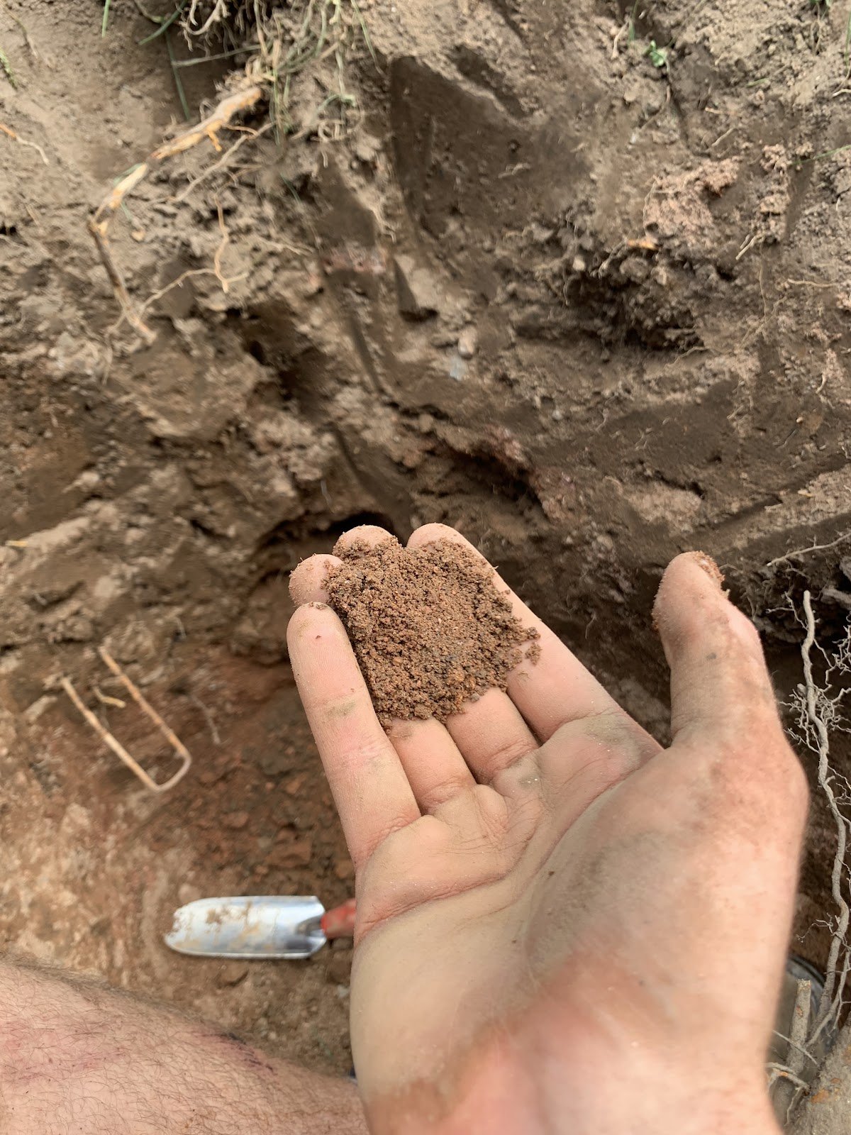
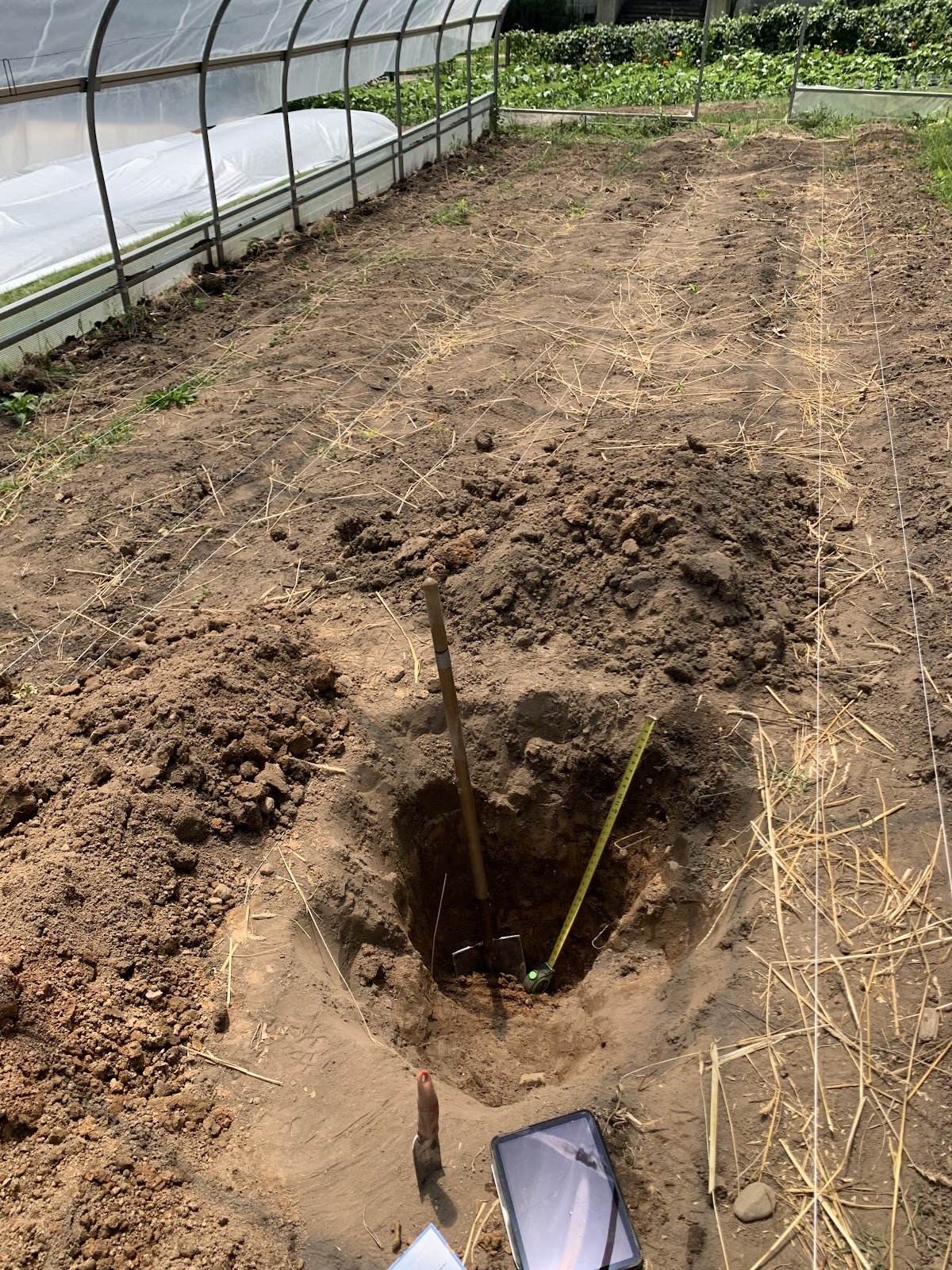
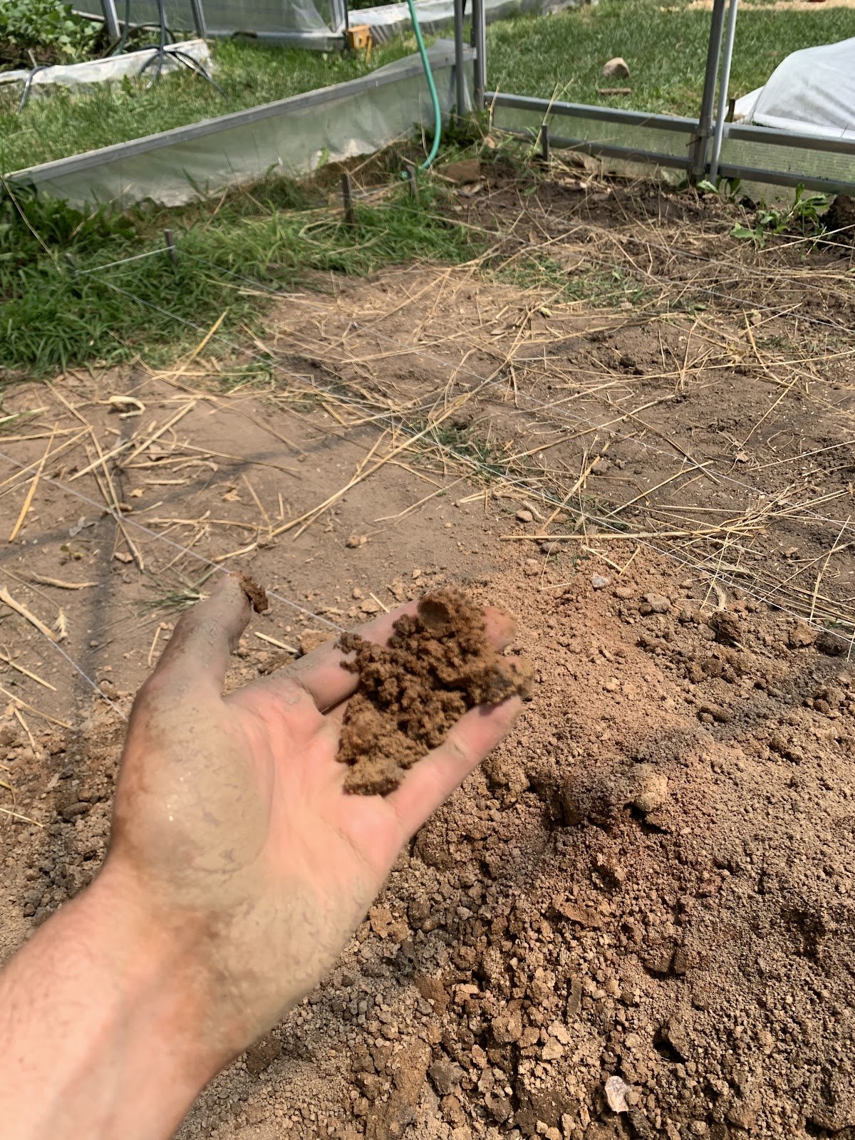
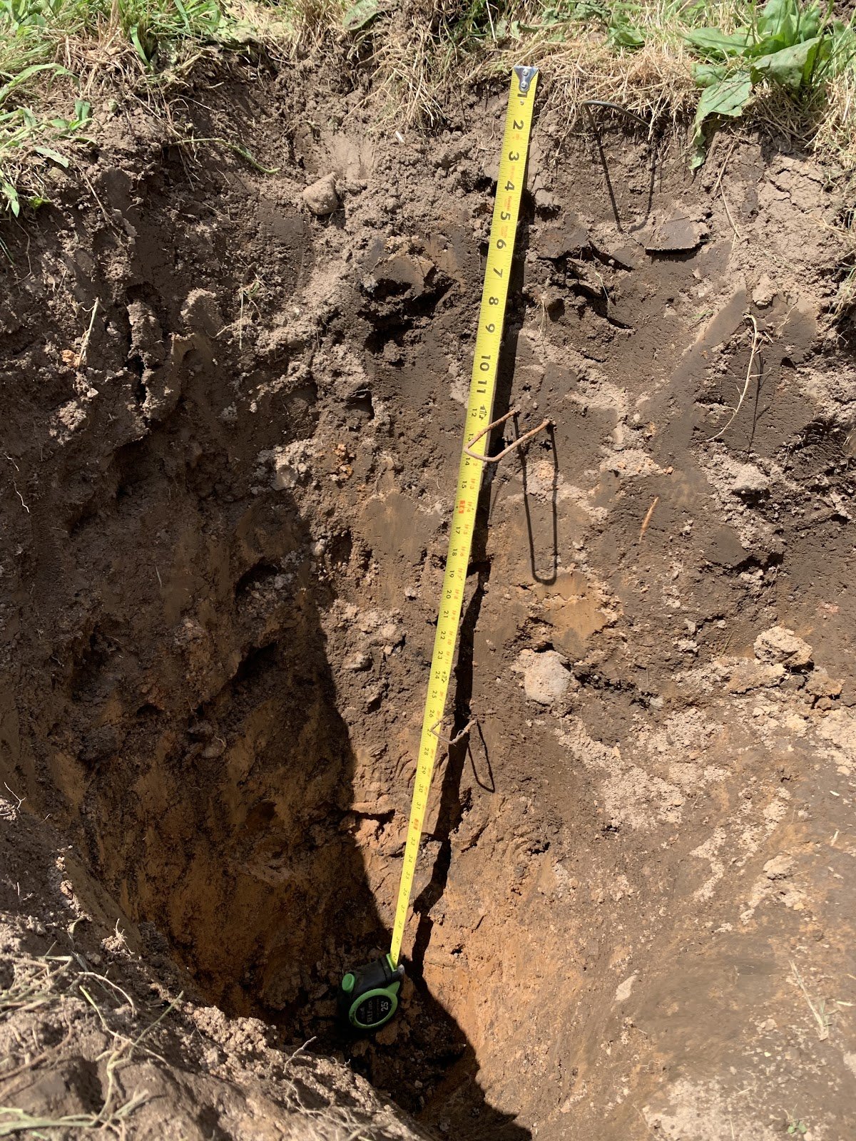
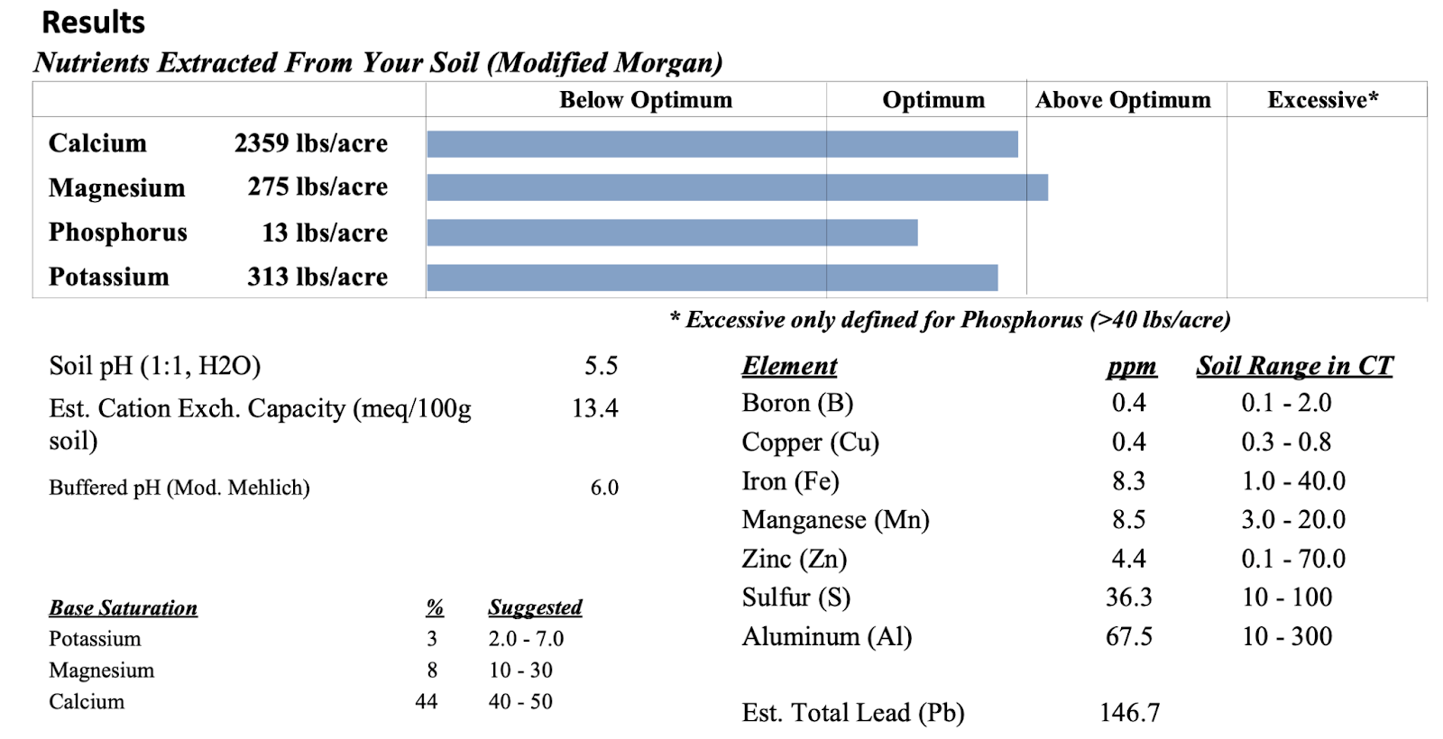
A series of four holes were dug to study these thoughts. Though more holes would increase the accuracy of the project, at a certain point too many holes would be beyond the scope of the project (digging is laborious and impractical for the farm). The location of each hole is denoted with an ‘X’ in the map above. Each site was selected to form a line down the hillside, in order to compare the soil at various points along the slope. A hole was additionally dug in field 2M to discover the effects twenty years of agriculture has had on the soil there, compared to the rest of the hill around it. At each site, the soil’s horizons, depth, texture, aggregation, relative wetness, color, and nutrient content was assessed. Texture was determined using the wire method; the Munsell soil color guidebook was used to determine color and aggregation; samples of the near-surface soil of each site were collected and sent to the University of Connecticut soil nutrient laboratory for analysis. Below are the physical results of the project.
Hill, 41.32041 N, 72.92198 W:

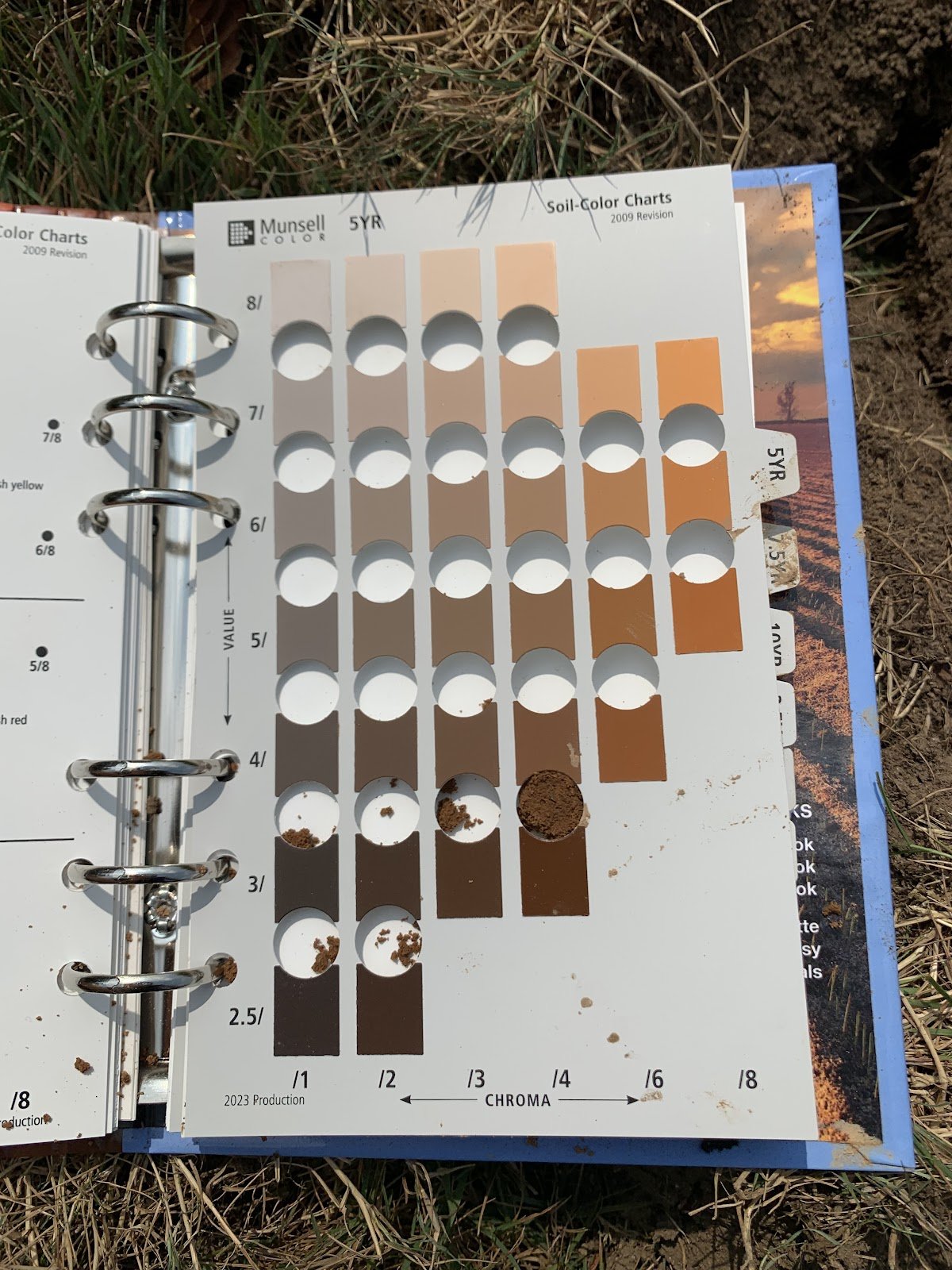
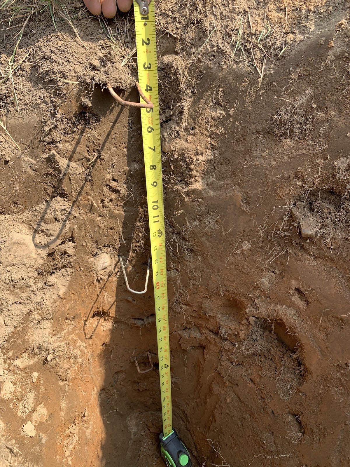
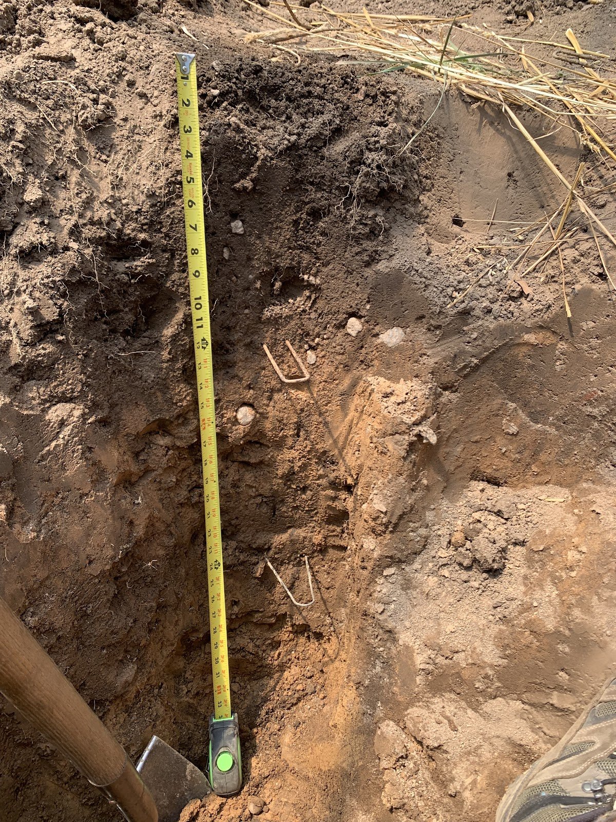
The soil at the hill site consisted of a sandy, well drained, reddish soil (increasing numbers before YR in the color column denotes a change in hue from red to yellow, i.e lower numbers before YR mean a redder hue). After around 26 inches of digging, I reached what I refer to (throughout this project) as the soil’s BC horizon. Though not quite a C horizon of unconsolidated rock, the BC horizon still largely contains soil particles, but is significantly rockier (and more annoying to dig) than the B horizon that lies above. At the risk of oversimplification, I will describe basic soil horizons: an O horizon consists of organic matter and detritus at the surface of the ground; an A horizon is the uppermost soil level, typically high in organic matter and home to plant roots; the B horizon is found below the A, and is lower in organic matter but higher in rock derived nutrients, which are weathered from the C horizon; the C horizon is unconsolidated rock material, just starting to be weathered in soil. Beneath the C horizon is rock. Texture and color changes commonly denote a change in horizon.
Upper farm, 41.32036 N, 72.92130 W:

The upper farm hole was the most difficult and confusing hole of the project. The soil there is very compacted, sandy (to the point I could not form a ball for the texture test), and shallow. After 28 inches of hard digging, I reached what I believed to be a C layer of solid, impenetrable red rock. This soil presented the same red hue as the hill site.
Field 2M, 41.32036 N, 72.92132 W:

Field 2M yielded a greater clay content than the two higher dig locations. This included a Bt horizon, referring to a translocation, or leaching, of clay to the B horizon of more than 20% increase from the upper horizon. 2M is also deeper (requiring 33 inches of digging before the BC layer was reached) and of a more yellow hue than the upper locations. The relative moisture of this site is altered by the field’s irrigation, resulting in a very dry surface soil, but wetter in the more clay-rich deeper regions.
Lower farm, 41.32036 N, 72.92133 W:
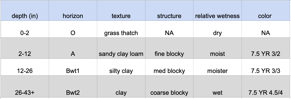
The most clay rich soil was found at the lowest dig site, which aligns with the topography principle of soil formation. This hole had the same yellow-ish hue of 2M, but required more than 43 inches of digging before any semblance of a BC horizon was reached. As a result of its clay content, it was the moistest soil of the project as well.
Overall physical results:

**relative wetness affected by irrigation schedules
The principle of topography and resulting soil properties largely hold true on the old acre. Lower dig sites tended to yield wetter, deeper, more clay rich soils, while the upper two sites were sandier, shallower, and drier. The upper farm site does preclude the farm from perfectly following the topography principle, with abnormally shallow and coarse for its slope position. This could be due to leaching from the slope it is on, but also could be a result of other factors, such as the berm lying above it trapping erosion from the upper slope, or the many tree roots that surround it. Another perennial possibility is that the land was altered by unbeknownst human activity. Upper soils also tended to be redder. I offer the following explanation: soil color is largely determined by the predominant oxidation state of the soil’s iron. Given the difference in moisture and other physical properties of the upper and lower dig sites, the iron oxidation could be likewise different, explaining the color difference.
The topography principle also has implications for a soil’s nutrient content. Nutrient leaching will often occur on slopes as a result of runoff, causing nutrients to settle at the bottom of a hill. Moreover, clays and organic matter, also more abundant at a hill’s base, generally have a greater capacity to hold nutrients due to greater particle surface area.
Hill:

Upper Farm:
2M:

Lower Farm:

Overall there does appear to be a greater concentration of nutrients, and a higher pH, at the base of the hill on the farm. While it is possible that this is due in part to topography and the accumulation of clay there, it is likely because the soils of the farm have been affected by 20 years of fertilization and lime application. It is therefore clear that years of farming has drastically increased the soil’s fertility and improved its pH. These improvements appear to not be limited to the field 2M, the only site currently being cultivated, but extend to the other on-farm sites (upper and lower farm holes). This could be a result of leaching of fertilizer, or due to an accumulation of nutrients at the base of the steeped part of the hill. Regardless, the data shows a greater nutrient content, pH, cation exchange capacity, and base saturation in the three on-farm soils tested in contrast to the hill site.
Revisiting the goals of the project, the four holes dug largely appear to uphold the topography principle of soil formation, as the project does show a trend of deeper, more clay rich and fertile soils at the base of the hill. Cultivated soils also tend to be more fertile and higher in pH, but this does not appear to be localized to beds that are currently being cultivated. Personally, it was great fun to get dirty, dig some holes, and practice some soil science techniques while investigating this unique characteristic of the Yale farm.